


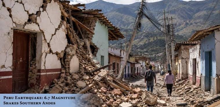
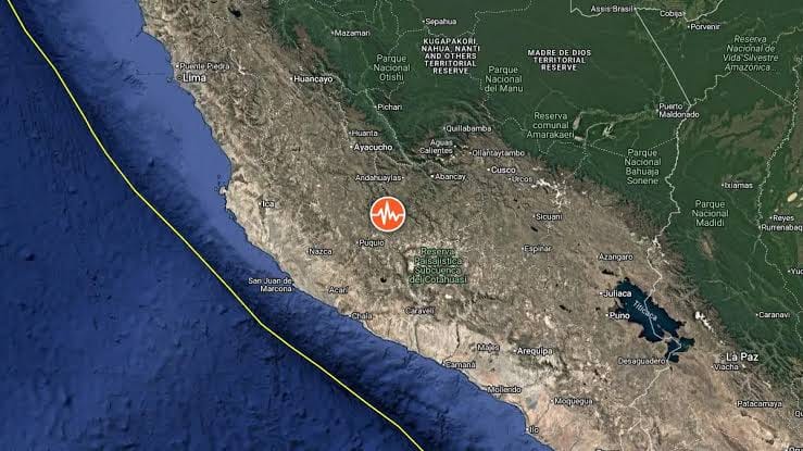
On August 20, 2026, at approximately 1:00 PM local time (18:00 GMT). The tremor was centered roughly 38 kilometers northwest of Upahuacho in the Parinacochas province of the Ayacucho region, occurring at an intermediate depth of 66 kilometers.
Impact & Key Details
- Casualties & Damage: Civil Defense officials reported at least 2 injuries during residential evacuations in Coracora. Structural damage includes 22 damaged homes, six health facilities, and one school across the districts of Puquio, Pullo, Coracora, Upahuacho, San Pedro, and Pichari.
- Perceived Shaking: The depth of 66 km absorbed much of the energy, reducing surface intensity to moderate shaking. Shaking was felt across southern and central regions—including Ica, Arequipa, Huancavelica, Apurimac, Cusco, and as far as the capital, Lima.
- Tsunami Risk: The Peruvian Navy and global alert centers confirmed there is no tsunami threat associated with this quake.
Geological Context
Peru sits directly on the “Pacific Ring of Fire,” where the Nazca Plate subducts beneath the South American Plate, generating frequent tectonic activity. The region regularly experiences major events, including the devastating magnitude 7.9 earthquake in Ica in 2007.